
HoneyGIS
Point data to honeycomb maps
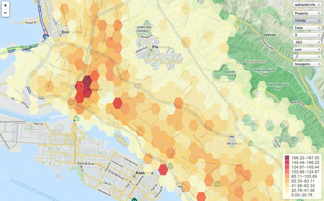
HoneyGIS is mainly added here for completeness as it was one of the first web prototypes I built. It takes a csv of point data and aggregates it into a themed honeycomb map. Options include quantile/equal interval theming, color scheme, size of the honeycomb and the aggregation type. It's super simple as it's only a couple hundred lines of HTML/Javascript, but most of my later apps are derived from this set of basic functionality.